
gis lidar services
GIS (Geographic Information System) and LiDAR (Light Detection and Ranging) are two technologies that are often used together to collect, process, and analyze data about the earth's surface and the objects on it
Lidar data Process
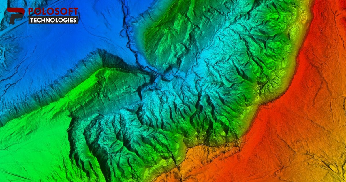
LiDAR is a remote sensing technology that uses lasers to measure distances between the earth's surface and objects on it. It can create highly accurate 3D maps of the earth's surface and is often used to create digital elevation models (DEMs) that show the height and shape of terrain
- LiDAR data is collected by aerial or ground-based sensors. Aerial sensors are mounted on airplanes or helicopters to collect data over large areas, while ground-based sensors are used to collect data over smaller areas
- Raw LiDAR data contains noise and errors that need to be corrected. Data calibration involves correcting for systematic biases, noise, and other errors in the data
- The filtered LiDAR data is classified into ground and non-ground points. This classification is based on the height of the points relative to the terrain surface
- LiDAR data is classified into different feature classes, such as trees, buildings, and roads, using automated algorithms or manual interpretatio